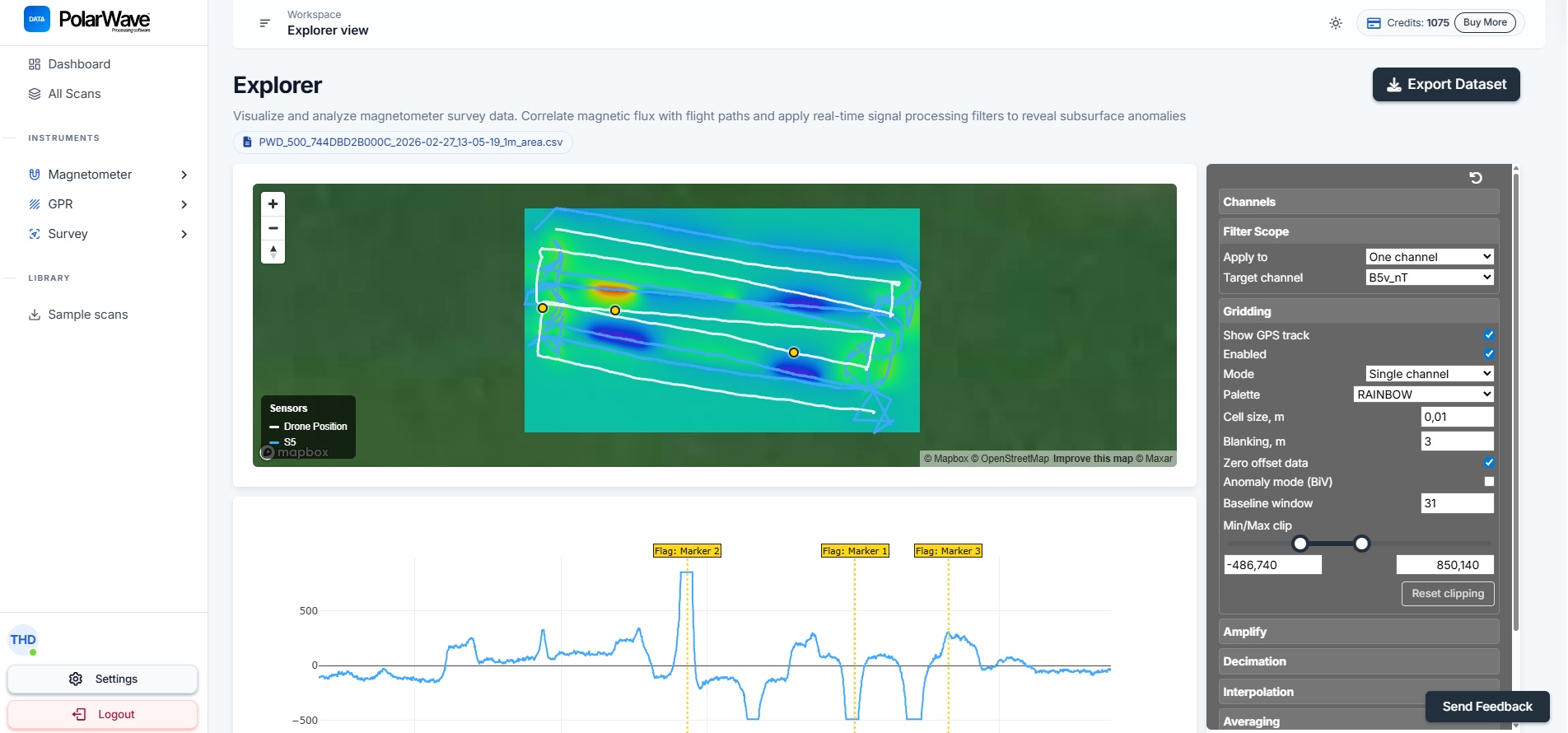

Every view, one platform
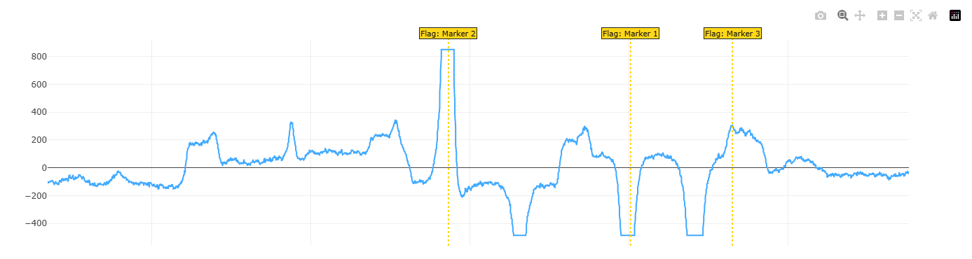
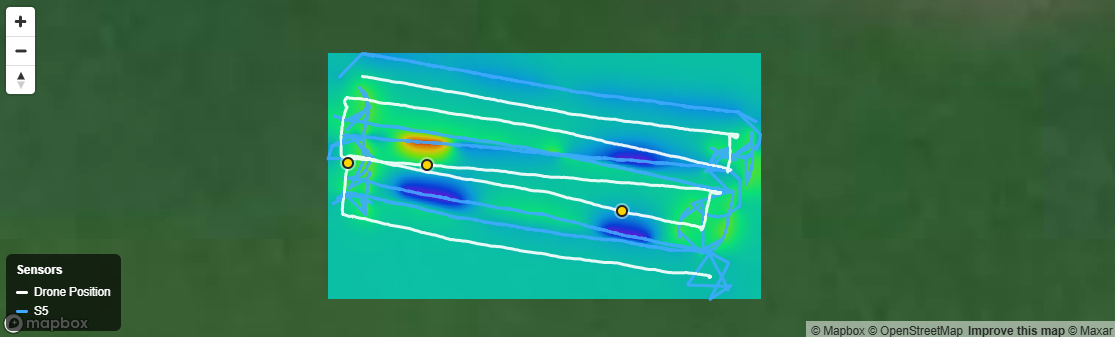
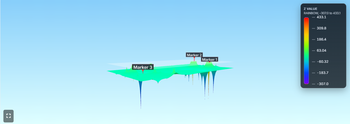
Upload once and switch instantly between profile chart, heatmap, and interactive 3D surface — no re-processing required.
- Device detected automatically from file
- Results in under 15 seconds
- Real-time filters on every view
Supported instruments
Automatic device detection — just upload your file
TreasureHunter3D
PolarWave
FG Sensors
GPR
Built for every survey discipline
One platform — many applications
Field Surveyors
Process data the same day you collect it
Upload directly from the field. Get a visual overview of anomalies within minutes — no specialist software or post-processing lab required.
Archaeology & Heritage
Map buried structures without breaking ground
Non-invasive GPR and magnetometer surveys reveal walls, foundations, and artefacts in their spatial context — shareable as professional PDF reports.
Utility & Infrastructure
Locate pipes, cables, and voids safely
Correlate multi-sensor drone passes with GPS coordinates. Identify subsurface hazards before excavation with colour-coded anomaly grids.
What surveyors say
Trusted by field surveyors, archaeologists, and engineers
We processed three days of drone magnetometer data in a single afternoon. The 3D view made anomaly identification far faster than anything we had used before.
The GPS overlay in Explorer is exactly what our utility team needed. We correlate scan tracks with site plans directly in the browser — no GIS licence required.
500 free credits let me evaluate the platform on real project data before committing. The PDF reports are professional enough to send straight to clients.
Choose Your Plan
Select the plan that works best for you
Standard Plan
Top up when you need more
100 credits per purchase
Credits never expire
Buy 100 CreditsPrices are in USD. Additional taxes may apply.
Frequently asked questions
Ready to process your survey data?
Start with 500 free credits. Works in any browser — no installation required.